
Several weekends ago my brother in-law and I hit the AT for a relaxing weekend in the woods. The weather was compliant and the varying terrain was terrific. We had both hiked the northern section of Connecticut's AT (Bear Mountain and Sage's Ravine) many times in the past but the Massachusetts AT wasn't so familiar.

Race Mountain
The Plan:
Drop off a car somewhere on US 7 in MA. Drive back to CT and start our hike northbound at the Undermountain Trail parking lot on Rt. 41.
The Trip:
Saturday morning we pulled into the closest business (Campo de' Fiori) to the AT on US 7, and asked if we could park our car overnight. The twenty something lady behind the counter said "Of course" as if I was silly for asking. I threw my pack in Anthony's car and we headed to one of CT's most popular trail heads. We took Undermountain Trail, hung a right on Paradise Lane Trail and skirted around Bear Mountain. We arrived at Sage's Ravine which was desperately clinging to winter. This is where we met up with the AT. The next several miles we hiked in snow and ice along the ravine's rushing water. Due to the immense snow melt from a hard winter the waterfalls and cascades were a sight to see. After a wet river crossing we dried our socks and shoes in the sun and ate our lunch. Peanut butter and Nutella on homemade bread was on the menu for me.

Mt. Everett
The first big climb of the day was Race Mountain (2365 ft.). This was my favorite part of the hike. As you approach the summit the trail takes you along exposed cliffs with awe-inspiring views. We followed the soaring red-tailed hawks all the way to the Apex. Gorgeous. We descended in more snow to the saddle between Race Mountain and Mount Everett where we passed The Race Brook Trail. (This past February I hiked in on Race Brook Trail and summited Mount Everett in some pretty deep snow. This is a highly recommended day hike.) We quickly started the steep ascent of the south slope of Mt. Everett (2602 ft.). At the summit lies four cement footings that supported an old fire tower. We stopped for a snack and found a rusty tin box with an old letter boxing stamp and notebook. I plan to go back with a replacement box and notepad; my mom will be proud seeing how she is an avid letterboxer. We climbed down to the Guilder Pond Picnic Area and continued north on the AT to the Hemlocks Shelter where we stopped for the night.
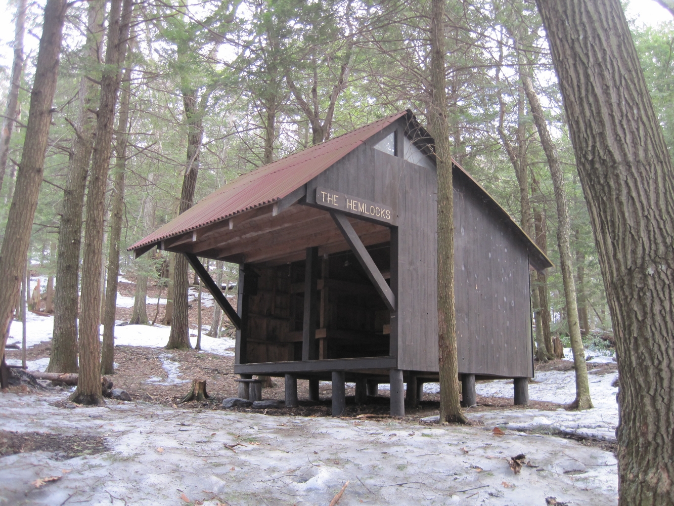
The Hemlocks Shelter is quite popular. It has ample room with two bunks and a large loft and it's newer than most of the shelters in the area. Dinner consisted of beans, rice, onions and peppers. This was my first time creating a freezer bag meal and it was a huge success. Delicious, filling, easy prep and hassle-free clean-up. I used my balaclava as my freezer bag cozy (I have since made a proper cozy from Reflectix insulation).

Breakfast in bed

Cold start on day 2


Very cool.
ReplyDeleteI like Propper Tru-Spec Atlanco Pants because these pants not only spoke to me,they entered my soul and transformed me.These are the pants truth wears.
ReplyDeleteHello. I just was poking around google images and found one of your pictures which led me to your web page. I just got home about 1 hr. ago from hiking several miles on the AT - a similar trip to yours. I started at Housatonic River (Kellogg Rd., Sheffield) and then walked to RT 44. Salisbury, CT. Awesome hike, but now it's time to take a nap..zzzzzzz
ReplyDeleteThanks for sharing.